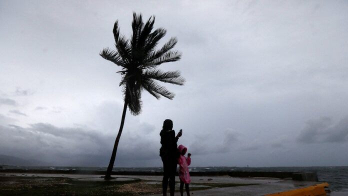
Jamaica is bracing for Hurricane Melissa, a Category 5 storm and the world’s strongest hurricane of 2025, with meteorologists warning of “catastrophic and life-threatening winds, flooding, and storm surge.” The system, currently packing winds up to 175 mph (282 km/h), is expected to make landfall in the early hours of Tuesday, unleashing destruction across the Caribbean island.
Melissa has already been blamed for four deaths in Haiti and the Dominican Republic, where flash floods and mudslides swept through communities over the weekend. Its slow pace — described by experts as a “crawl” — has raised fears of torrential rain, flooding, and landslides that could persist for days.
Why is Hurricane Melissa considered so dangerous?
According to US meteorologists, the danger lies not only in the hurricane’s immense power, but also in its agonisingly slow movement. The storm is currently turning toward Jamaica at a pace slower than a walking human, meaning it will linger longer over land, dumping rainfall measured in feet rather than inches.
“The calm, 11-mile-wide eye of Hurricane Melissa is encircled by its most ferocious winds,” forecasters explained, noting that this configuration would subject the island to sustained hurricane-force conditions for an extended period.
WATCH | Satellite imagery reveals the “stadium effect” — the awe-inspiring yet terrifying eye of Hurricane Melissa as it barrels toward Jamaica.
What is happening inside Melissa’s breathtaking ‘stadium-effect’ eye?
From above, Hurricane Melissa’s eye presents a stunning sight — a vast, circular void surrounded by towering walls of clouds, a phenomenon known as the “stadium effect.” A meteorologist who flew into the eye of the storm described the experience to The Washington Post:
“Even though Melissa was mighty, it seemed relatively small. That’s the secret to hurricanes — compared with midlatitude, nontropical storm systems, they’re tiny. But they pack all their power into that small area, leading to extremely potent winds and waves.”
Meteorologist Cappucci elaborated further: “Melissa looked like a telltale Category 5 on satellite, but technically it was harbouring Category 4 winds. It was still intensifying, however. By the time we entered the eye, I figured it might reach Category 5 strength.
As we entered the storm, darkness fell. The sun had set, but the darkness looked, somehow, thicker. I could barely see the wing of the aircraft through the dullness. The outside wasn’t a dark abyss, but rather a dismal murk.”
How does a hurricane create such intense energy?
Meteorologists explain that hurricanes derive their ferocity from the ocean’s heat energy. In Melissa’s case, warm, moist air spirals inward, rising rapidly and creating a void of low pressure that fuels more violent winds.
Experts noted that Melissa’s core contained an 8% air deficit — meaning nearly one-tenth of the air was lifted out of its centre, intensifying the inward rush. This process forms towering rings of thunderstorms that reach heights of 50,000 feet.
As air within the eyewall collides with the tropopause, it rebounds downward, warming and drying as it descends — forming the eye’s “oasis of calm.”
Why is the eye of Hurricane Melissa so warm?
The interior of the storm’s eye functions like an atmospheric chimney, trapping and recycling heat. The meteorologist recalled:
“I noticed I was beginning to sweat. Then it hit me: I was in an atmospheric chimney. Hurricanes are warm-core systems, marked by a pillar of warmth at their cores. And the temperature inside the eye, even at flight level, was 16 degrees warmer than outside. Even at close to 10,000-feet altitude, it was still swelteringly warm and humid.”
This trapped heat — a defining characteristic of a warm-core system — drives the hurricane’s engine, keeping Melissa’s winds at catastrophic intensity.
What lies ahead for Jamaica?
As Hurricane Melissa edges closer to the island, officials are urging residents in low-lying and coastal areas to evacuate immediately. The Jamaican government has declared a state of emergency and deployed rescue teams in anticipation of widespread devastation.
Experts warn that Melissa’s slow advance could result in unprecedented rainfall, crippling infrastructure, and massive storm surges along the coast.
While meteorologists acknowledge the storm’s scientific perfection, they stress the human toll that will follow.
“Melissa was strengthening into a Category 5 hurricane that would inevitably bring catastrophe for many,” one forecaster said. “As a scientist, I can appreciate meteorological perfection — after all, that’s the only way to get a storm of Melissa’s calibre.”
hurricane, Hurricane Melissa, Category 5 hurricane, storm surge, torrential rain, Category 5 storm, Jamaica, catastrophic winds, flooding, ferocious winds, rain totals, meteorologist
#Jamaica #faces #worlds #strongest #storm #Eye #Hurricane #Melissa #shows #breathtaking #stadium #effect #Watch

