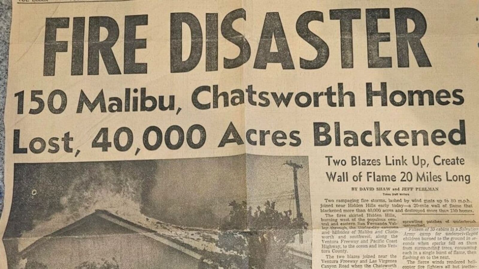
“Two blazes link up, create wall of flame 20 miles long,” the subhead to the article states. The articles mention that the out-of-control fires heaped destruction in 7 Southland counties.
While the second image shows the map of the places devoured in the wildfire, the third image captures emergency and rescue operations. It also depicts the agony, anxiety, fear and bravery of residents who faced the disaster.
Social media reactions
Social media strongly reacted to this post as one user commented, “The Palisades fire right now in that same spot – 22,000 acres burned and 10,000+ homes destroyed.” Another user replied to this thread, “Seems to only be worse due to increased home density.” While some users pointed to “high fire risk” area, others alleged that these wildfires are a result of climate change.
A third user took a jibe at the disaster and wrote, “Well good thing it’ll never happen again, time to rebuild a bunch of homes there.” A fourth user commented, “A bunch of Santa Rosa (up in the northern Bay Area) burned down in 2017, and that exact same area basically had also been burned down before in 1964. History really does repeat itself. Many people have re-built their homes in the areas that burned, which seems like a wild choice.”
A fifth user referred to the LA map and said that his father lived through these fires at age 9. Detailing his father’s survival story the user noted that his “family lived in a house in Chatsworth (their home is actually the green dot on the map in pic 2, and his school is the green x).” He added, “He told me he remembers evacuating with his mom and sisters, sitting in the back of their car, and seeing flames engulfing both sides of the road.”
Fatality, destruction and damage
According to AFP, at least 16 people have been killed in the wildfires. Official figures suggest that over 12,000 structures have been burned. A fire official noted that all these structures were not only homes, as they included outbuildings, recreational vehicles and sheds, among others. Due to the raging fires, nearly 2,00,000 have been displaced.
According to the New York Post, the Sunset fire has been contained, the Hurst fire burnt 771 acres of land, the Kenneth fire engulfed 959 acres and the Eaton fire burnt 13,690 acres. Palisades fire has been the most destructive which burnt 19,978 acres of land. Nearly 35,000 acres of land was reduced to ashes.
wildfire in los angeles, fire los angeles, fire, los angeles map, wildfire map, wildfire map los angeles, california wildfire, los angeles california, los angeles california wildfire, california, la, wildfire la, los angeles wildfire 2025, fire in los angeles, wildfires los angeles, fire map los angeles, wildfires, fire map, fires los angeles, wildfire in california, la fire, california fire, palisades los angeles, palisades, palisades wildfire.
#Los #Angeles #wildfire #Netizens #react #55yearold #newspaper #History #repeat
